Features Multicarto France
Multicarto provides easy access to a selection of reference maps on French territory, and practical and useful map functions, for simple or more advanced uses.IN FREE AND FREE ACCESS
❤️
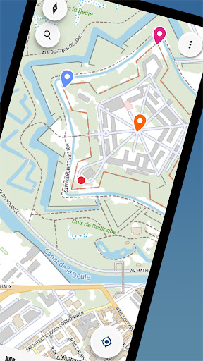
🗺️ Multi-scale IGN map
🗺️ Multi-scale OSM map
🗺️ Mixed (aerial photo and roads)
🗺️ Aerial photos
🗺️ Recreational drones and model aircraft
🗺️ Map of Cassini (18th)
🗺️ Military map (1866)
🗺️ Map 1950
🗺️ Aerial photo 1950Free access features:
✔️ Saving points of interest (unlimited)
✔️ Import of data in KMLet GPX format (5 imports)
✔️ Course recording (5 courses)
✔️ Export of points of interest and routes in KML and GPX format
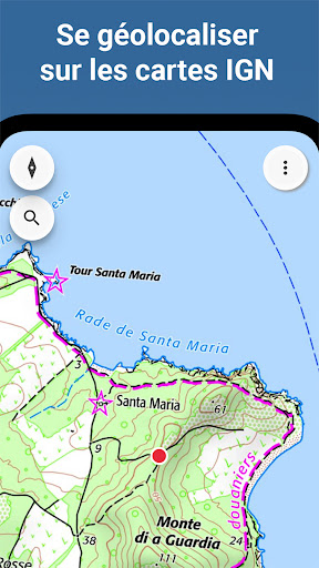
✔️ "Where am I?" gives you the complete address or the municipality of your location
✔️ Display of coordinates (in geographic, UTM, Lambert 93, Open Location formats)
✔️ Display of the altitude of a point on the map
✔️ Map sharing on social networks, sending by email, SMS, etc.
So easily share a map extract with your position
✔️ With the sharing feature, also print your maps in compliance with the conditions of use of IGN dataIF YOU WISH, WITH THE PREMIUM SUBSCRIPTION
❤️
❤️
❤️
🥾 IGN hiking map (1:25,000)
🏰 Tourist Map (1:100,000)
🚘 Road map (1:1,000,000 and 1:250,000)
📐 Cadastre (source IGN and DGFiP)
🛩️ ICAO aeronautical chart
⛰️ Slope mapPremium Features
✔️ Save maps for offline viewing (off network, offline)
✔️ Unlimited imports
✔️ Unlimited route recording
✔️ Display of dimensions of cadastral parcels and their surfaces
➡️ About Premium MembershipAccess to all maps and saving maps for offline viewing are free for 7 days.Take the opportunity to test everything!
Beyond this period, you will be invited to subscribe to the Premium subscription.The subscription is made EXCLUSIVELY via the PlayStore: you thus benefit from all the security and confidentiality required for the purchase, and the flexibility for the payment: CB, gift card, payment on invoice of your operator, PayPal.
.
❤️ If you dont want to take out a subscription, you can continue to use all open access features for free.IMPORTANT
👓- An internet connection is required for searching geographical locations, displaying elevation and presenting extended cadastral parcel information.- Certain maps and content are distributed via the Geoportal (IGN Geoservices) or other data providers.In the event of a display problem, you can use the "Quality of Services" link in the application to check that third-party services are working correctly.- The application developer cannot intervene on the information present on the cards: any comments on a card should be made directly to the producer of the data.- The cartographic contents are offered for information purposes only, with the exclusion of any guarantee as to their accuracy or their suitability for specific needs.A request, a suggestion?
Contact us at [email protected]!Also, dont hesitate to tell us how you use Multicarto for your hobbies, studies or work
🙂
Social Features
Connect and share with friends and the community.
Gaming Features
Enjoy immersive gaming experience with various game modes.
Camera Features
Advanced camera features with editing capabilities.
See the Multicarto France in Action
Get the App Today
Available for Android 8.0 and above